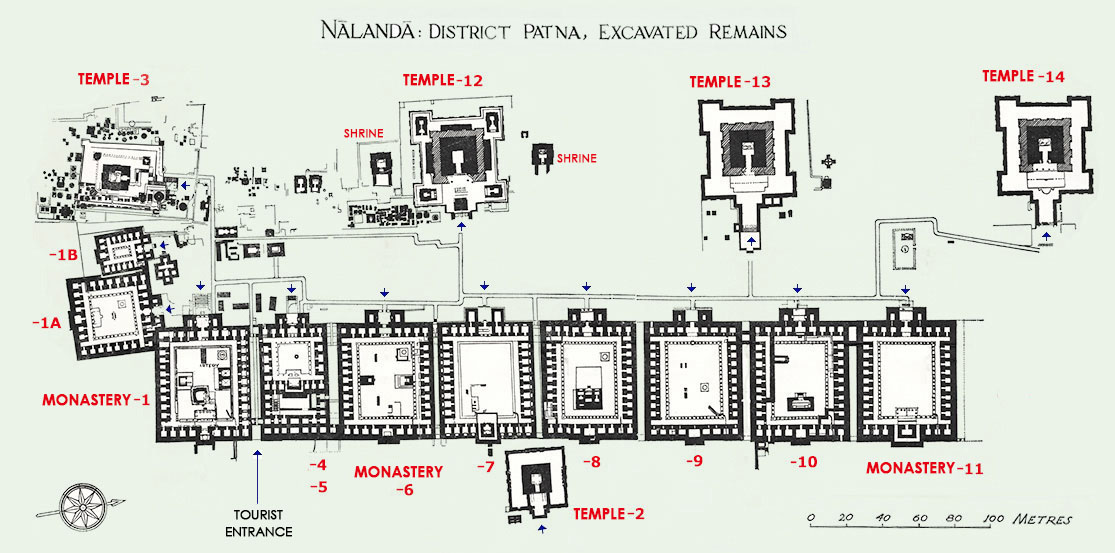
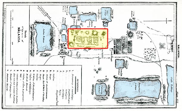
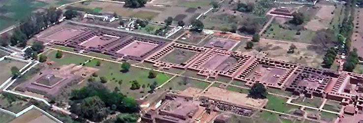
- Excavated by the Archeological Survey of India from 1915, a hundred years ago, the total picture of the Nalanda Mahavihara came to be disclosed to us.
- The extensive open space between the lines of monasteries and temples might have been a square-like broad main street.
- Along this street must have been erected many stores and refectories of wood, giving liveliness to the 'university town'.
- The current paved streets are not original but arranged for visitors after the excavation.
- Monasteries and temples were numbered by the A.S.I. without distinction between the sorts of buildings, perhaps instead in the order of investigations.
- Monastery-4 is shorter in depth and its later enlarged part (Annex) was numbered 5.
- To the north of Monastery-11 might have been expected further monasteries to be constructed in accordance with the augmentation of students.
- As they were the monasteries in the era of Maha-yana Buddhism, their innermost central rooms enshrined statues of Buddha.
- Since the Mahavihara was overall akin to a university consisting of residential college-like monasteries like Cambridge or Oxford, it came to be called 'Buddhist University'.
|